


The Scudamore of Kentchurch estates survey c.1790
The Scudamore connection with Kentchurch Court goes back for hundreds of years. The family has a private archive of material concerning the court and its estates. One of the items is a volume of maps of different holdings and land belonging to the estate in Herefordshire and Monmouthshire, each accompanied by a list of the fields, acreage, and sometimes details of the tenants (a book of reference). This dates from circa 1790. Twenty-nine separate items are so documented, but some consist of more than one farm. Because the maps must be shown in high resolution, it has not been possible to present the volume as a single item. Click on the holding name and a pdf file will open with the estate map and the book of reference alongside or following on a new pageThe pdf file can be downloaded - see top left of the open webpage. Some holdings cross parish boundaries which made comparison with other maps more difficult, especially as some parishes have changed county and country since the survey was compiled, but the properties have been identified by matching field shapes. The information for each holding is keyworded with the names of the propert(ies) and the parish(es). If the property has changed name both the 1790 and the modern name will be given as keywords. Personal names are not keyworded.
Most of the maps have a compass rose and a decorative cartouche surrounding the name. Two have within this a vignette of a building, either a church or a house which seems to be the house concerned. This will be noted against the entry. The properties are listed below in the order in which they appear in the volume. Where a property appears in the surveyors' notebooks of the Royal Commission for Historic Monuments of England (RCHME) this is noted, but unfortunately the Club has been refused permission by Historic England to display these on the website. However, the RCHME volume for this area of Herefordshire can be accessed here. Scroll down the page to see all the entries. For Herefordshire entries additional information has been given where possible. The HER code is the reference for the Herefordshire Historic Environment Record (old SMR) and by entering the code in the HER database the details can be found, including the grid reference which can be used to find a site on the 25in OS maps. Follow this link and enter the grid reference from the HER entry or that given below. Unfortunately for this part of Herefordshire the OS maps which usually shade the living accommodation as pink and the outbuildings as blue are all in pink. The estates which are wholly in Monmouthshire have not been analysed to the same detail as those in Herefordshire. However, the Monmouthshire HER can be accessed by following this link, putting in the name of the parish and scrolling down through the entries though there may not be an entry for the farm in question.
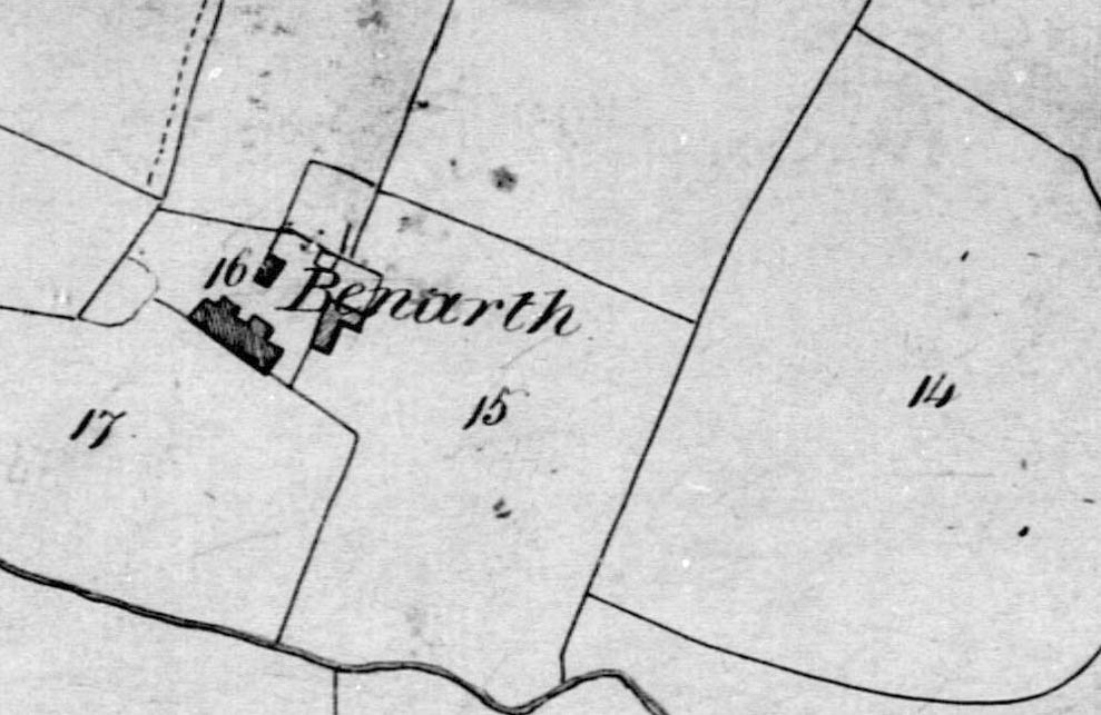
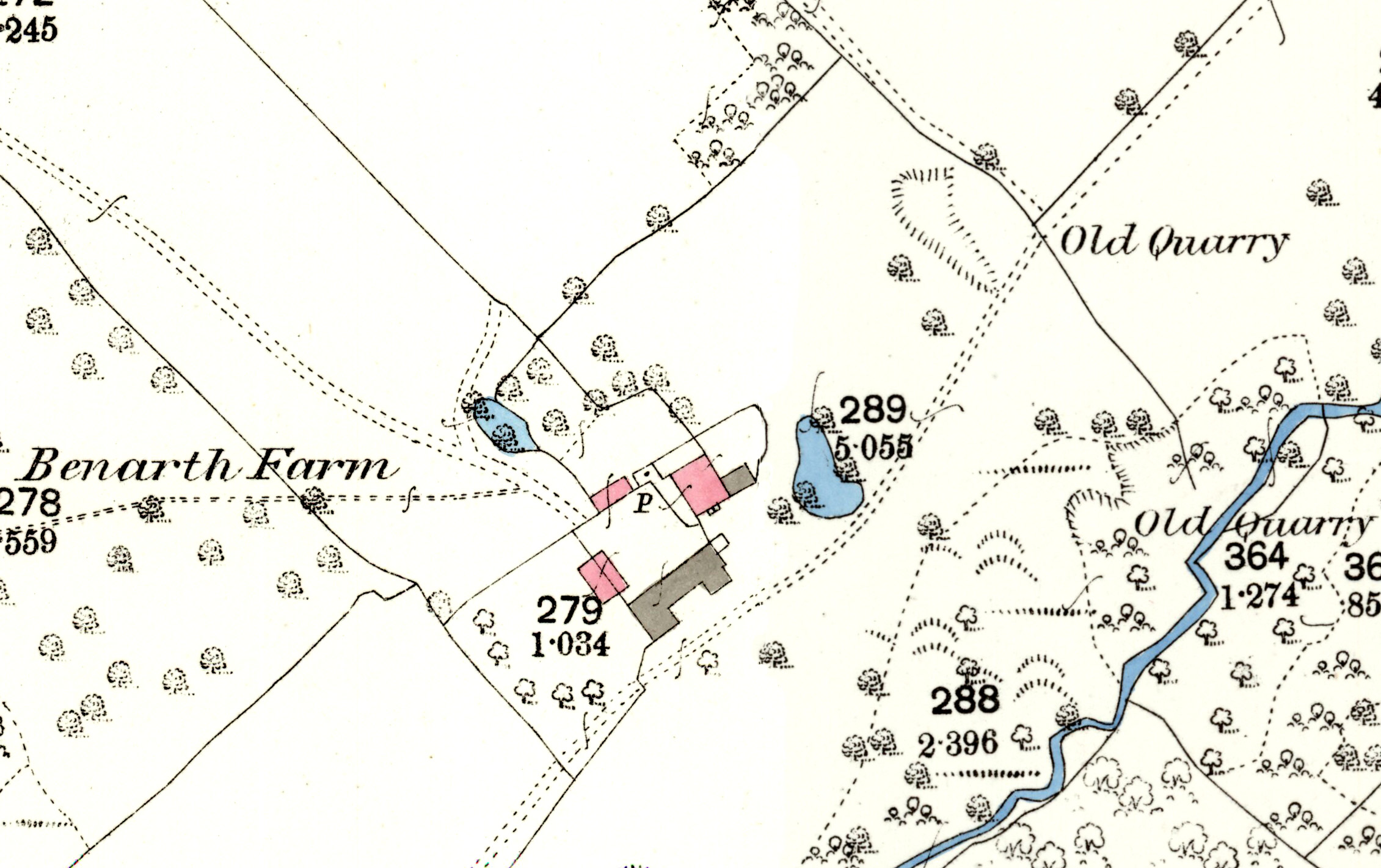
1. Benarth and New House in Kilpeck, Kenderchurch and Kentchurch
Benarth homestead is no. 12 on the estate map, plot 16 on the Kilpeck tithe map and HER 6792. The vignette shows a tower-like block with an entry stair into a small room with a sloping roof. A large chimney projects from the roof and there may be a garderobe (early lavatory) on the right. The 1885 OS map shows that only this block is the dwelling part (the square block in pink) but by the time the RCHME surveyor inspected it in 1929 an outbuilding to the east had been converted to living accommodation.
2. The Bannut Tree, Kentchurch
The Bannut Tree farm is no. 14 on the estate map, no. 409 on the Kentchurch tithe map and HER 33649.
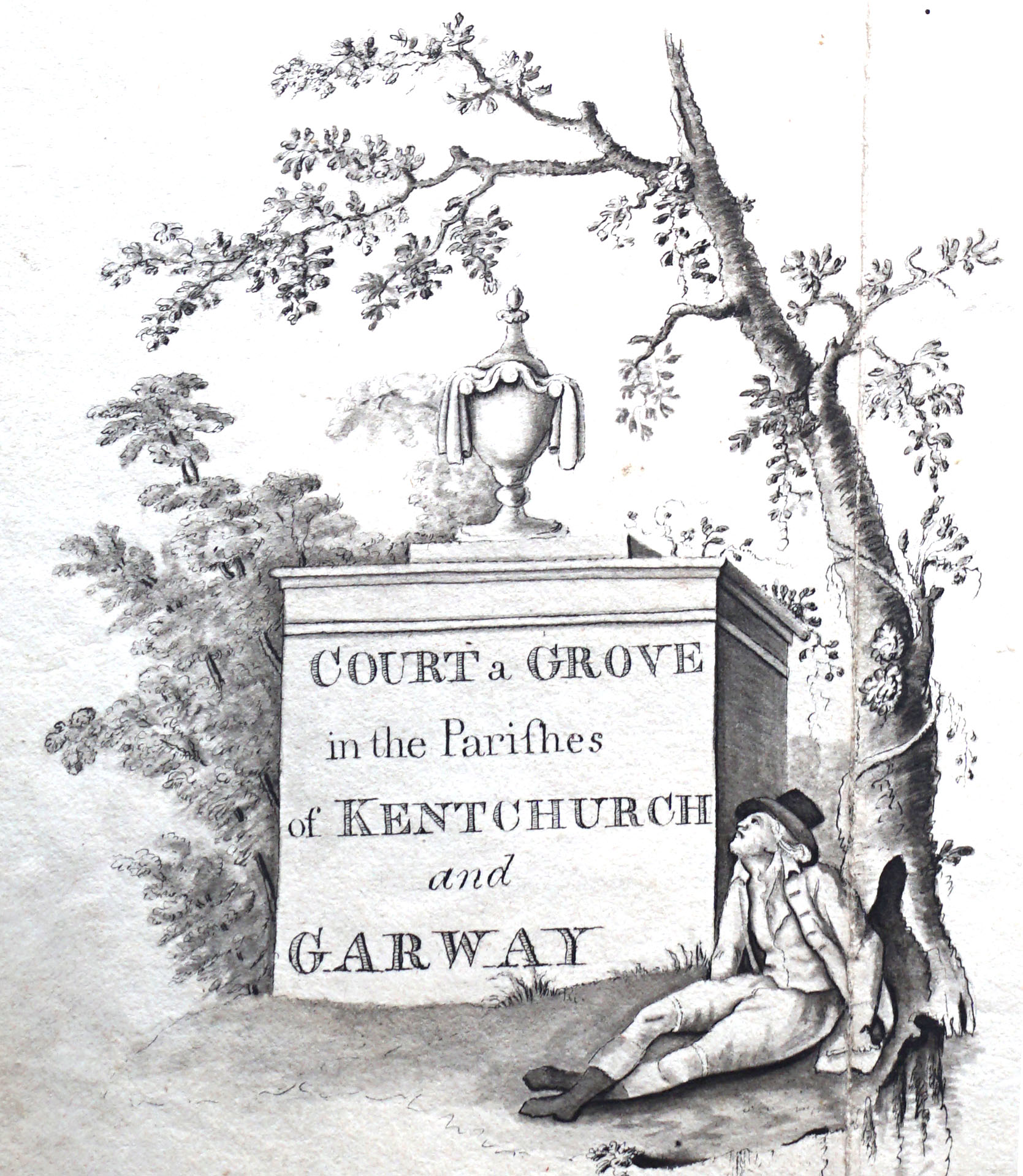
3. Court a Grove and the Berry, Kentchurch and Garway
Court a Grove homestead is no. 1 on the estate map, 426 on the tithe map and HER 32822. It has a decorative vignette but no building is shown. No RCHME record.
4. The Kitchen, Garway and Kentchurch
The Kitchen is no. 1 on the estate map, 426 on the Garway tithe map and HER 48419.
5. Howton (Grove) Estate in Kenderchurch, county of Hereford
The homestead is shown as nos. 1 and 2 on the estate map; no. 14 on the Kenderchurch tithe map where it's called Houghton Grove and HER 45370. No RCHME record.
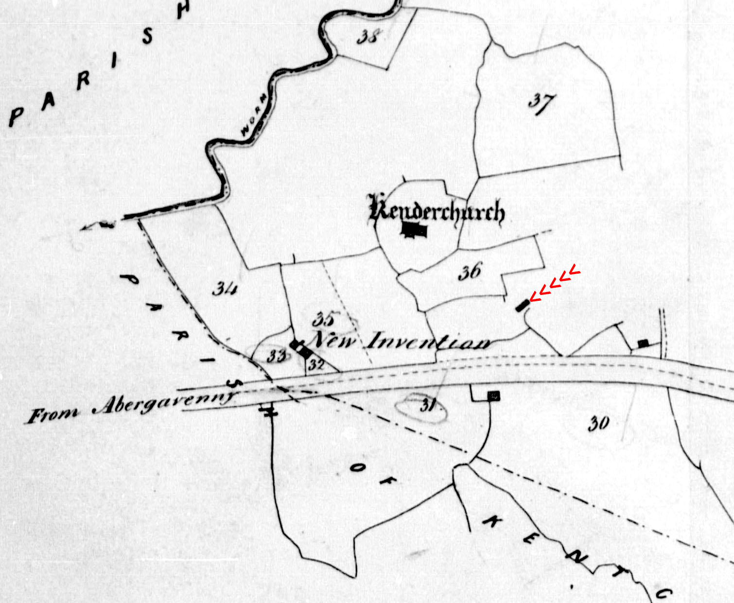
6. A Messuage and Farm of Kenderchurch
The homestead was a small distance to the east of ‘New Invention’, as can be seen arrowed in red in this extract from the tithe map. By the time of the 25" OS map of the 1880s the building had disappeared.
7. Merryvale, Kilpeck, county of Hereford
HER 6796. Merryvale is unnamed on the Kilpeck tithe map plot 170 but called Merryfold on the 1880s 25in OS map. The RCHME surveyor visited it in 1929 and said it was 17th century; their photo shows a typical longhouse. The vignette shows a church and a domed garden 'temple'.
8. Howell’s in Kilpeck, county of Hereford (or New Barns)
HER 47347. Plot no 133 on the Kilpeck tithe map where it is called ‘The Farm’
9. The Hill, Kentchurch, county of Hereford
The homestead is called ‘The Hill’ on the Kentchurch tithe map and is plot no 54. The vignette shows a fair-sized house and tallies with the shape of the dwelling house on the 25" first edition OS map; the building with a slatted roof is perhaps a dovecote which is shown a a small outshoot on the OS map. Unfortunately the RCHME surveyors do not appear to have considered the house.
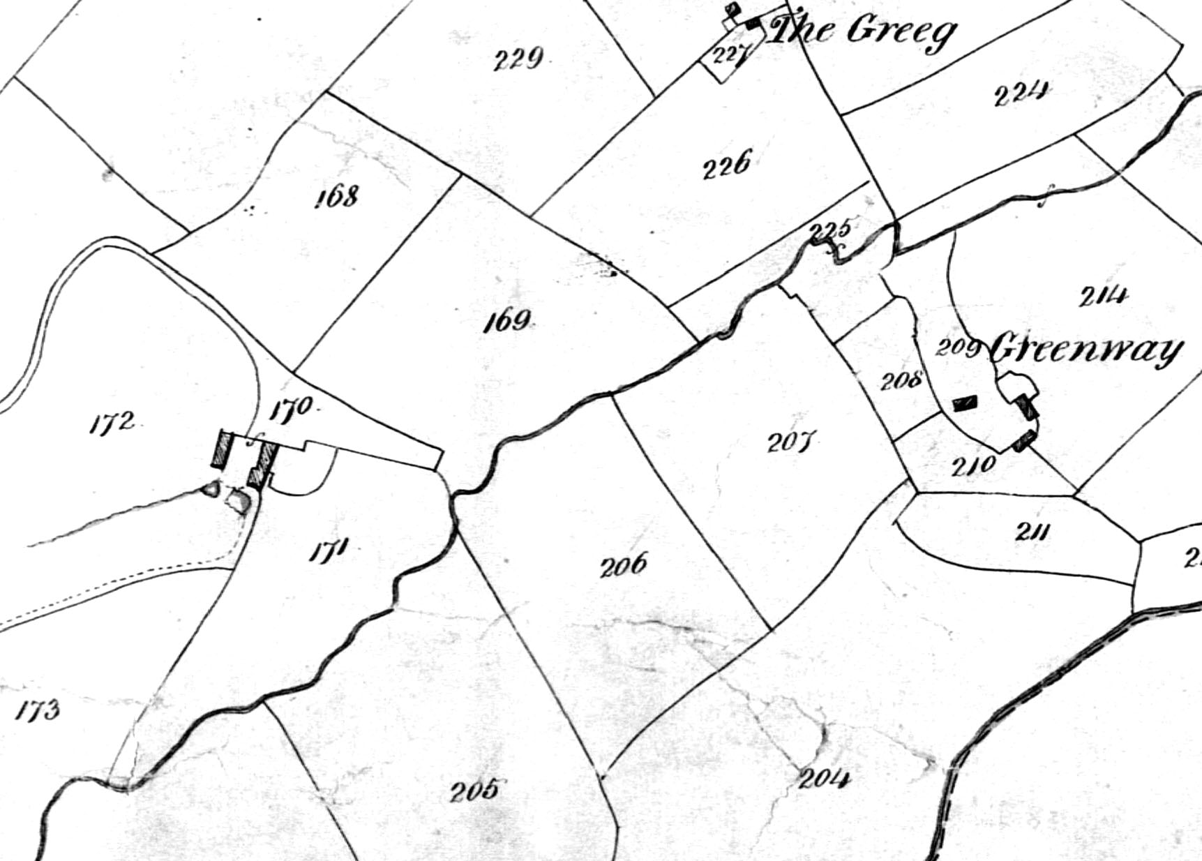
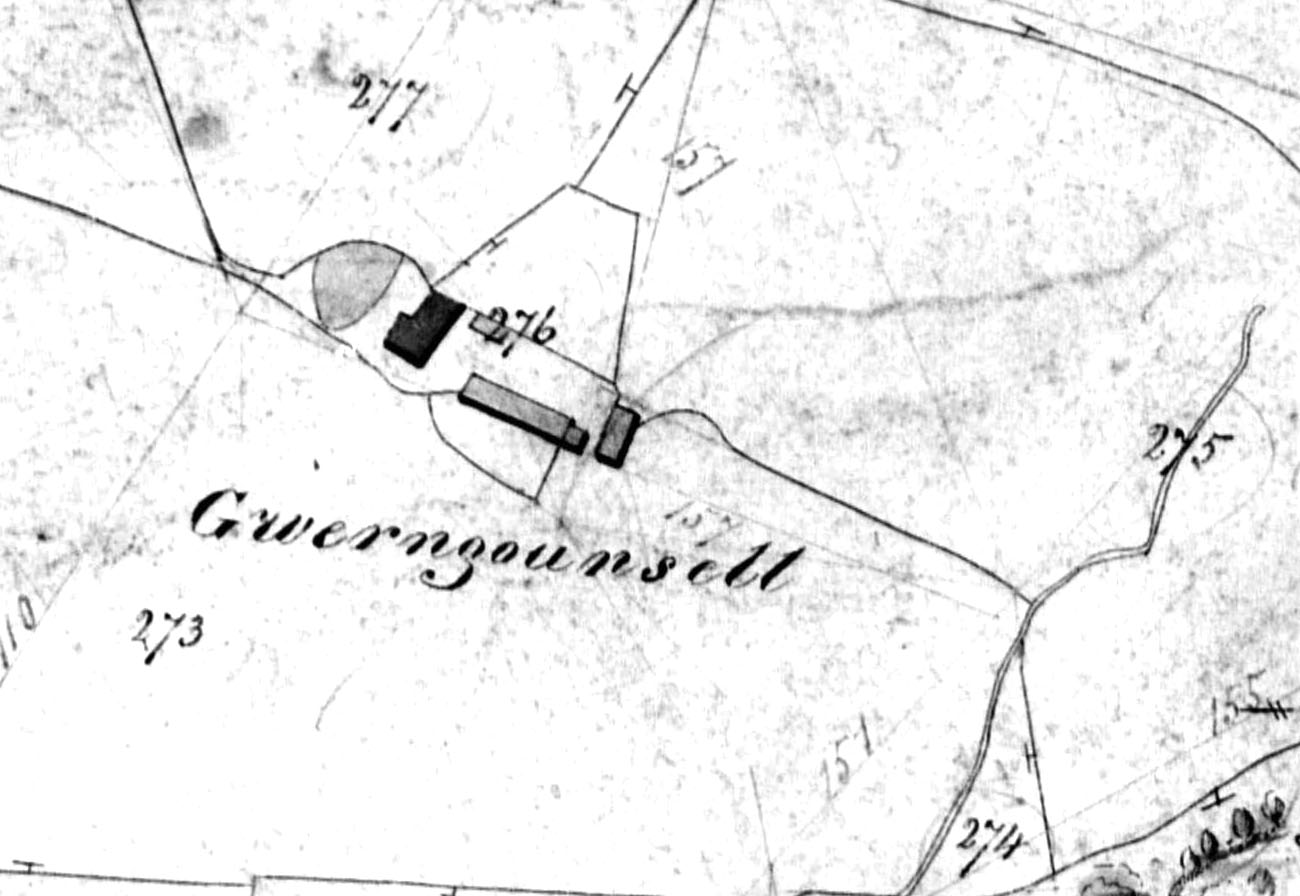
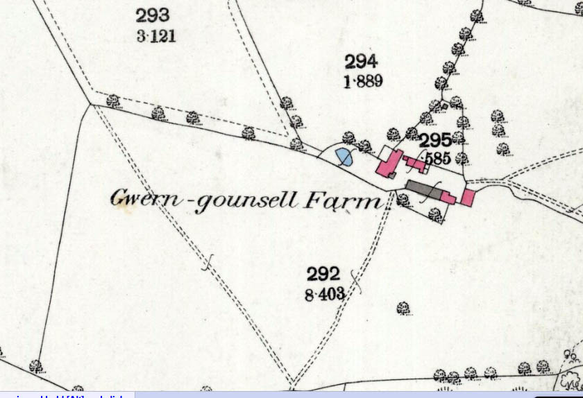
10. Wern Counsel, Kentchurch, county of Hereford
Also called Gwern counsel or Gwern-gounsell. HER 47363 and plot 276 on Kentchurch tithe map. Gwern-gounsell on the 1880s 25in OS map.
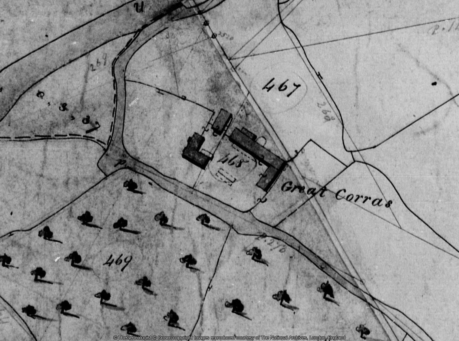
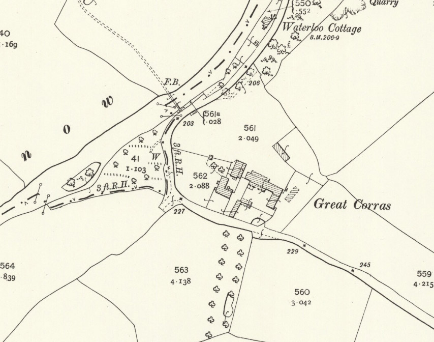
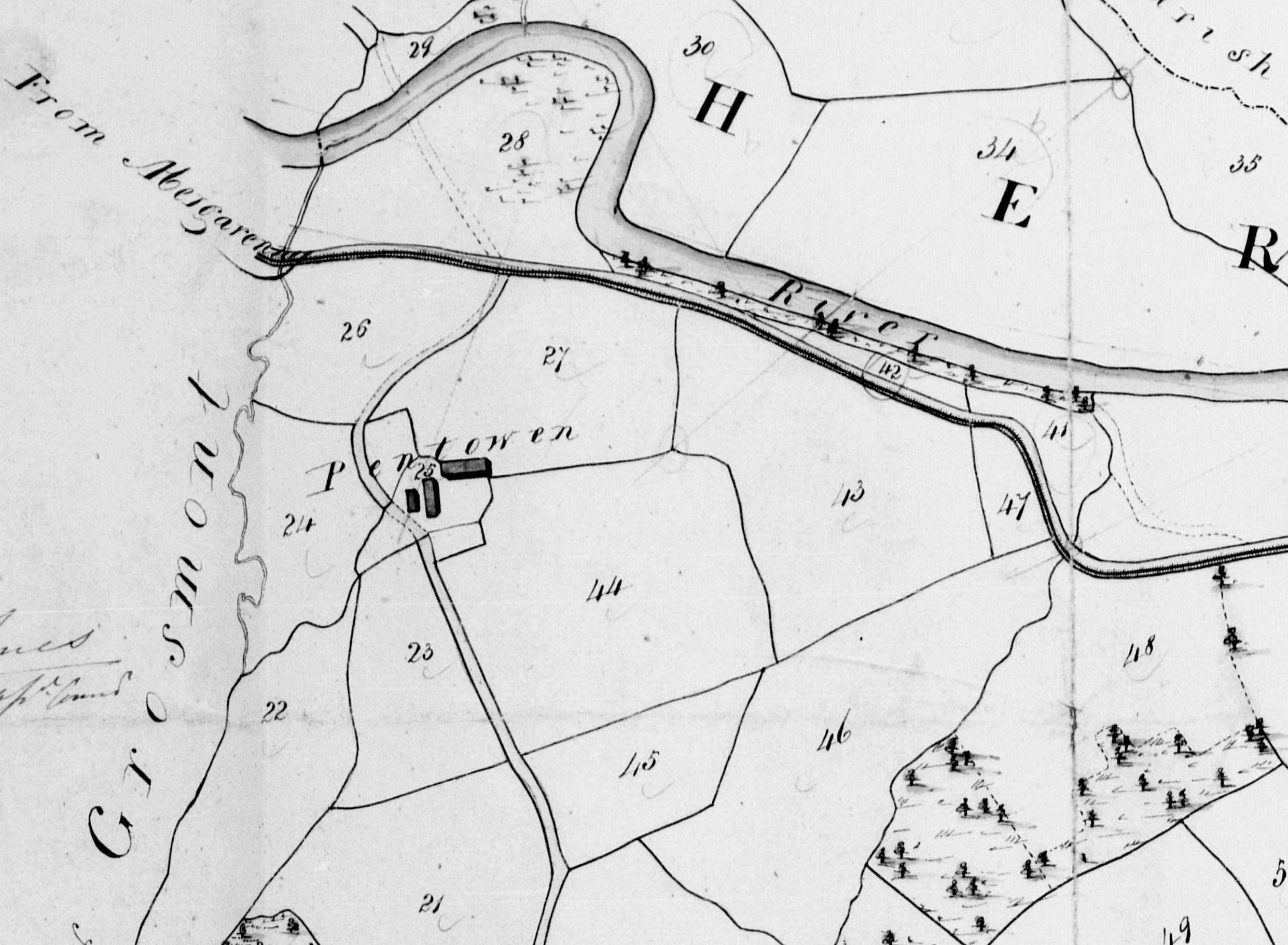
11. Corras and the Lawns, Kentchurch and Grosmont, counties of Hereford and Monmouth
Great Corras. HER 47366 (main farm). There are nearby sites of motte, shrunken village, chapel and warren. The farmhouse is no. 465 on the tithe map.The 1903 25in OS map show the house building outline mostly unchanged.
The Lawns lie over the river Monnow from the farmhouse and are in the parish of Grosmont and county of Monmouth.
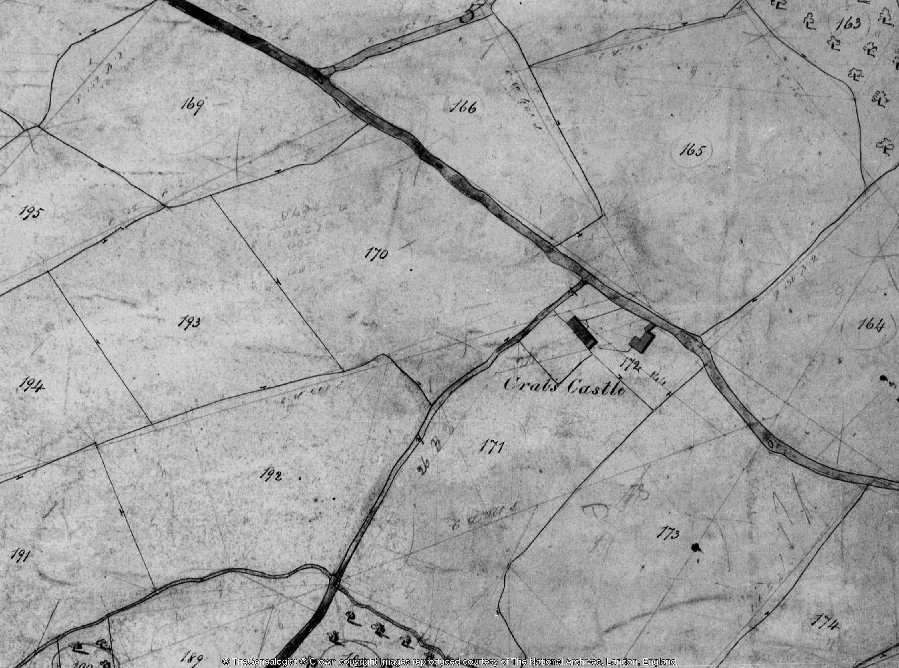
12. Crabs Castle, Kentchurch, county of Hereford
HER 33773. No. 172 on tithe map, and on 1887 25in OS map.. SO 43794 27286. Identified by RCHME as early 17thC cottage monument no. 7.
13. The Farm, Grosmont, county of Monmouth
14. The White House, Grosmont, county of Monmouth
15. Blaentrothy, Grosmont, county of Monmouth
16. The Cefn, Grosmont, county of Monmouth
17. Little Camson, Llangattock, county of Monmouth
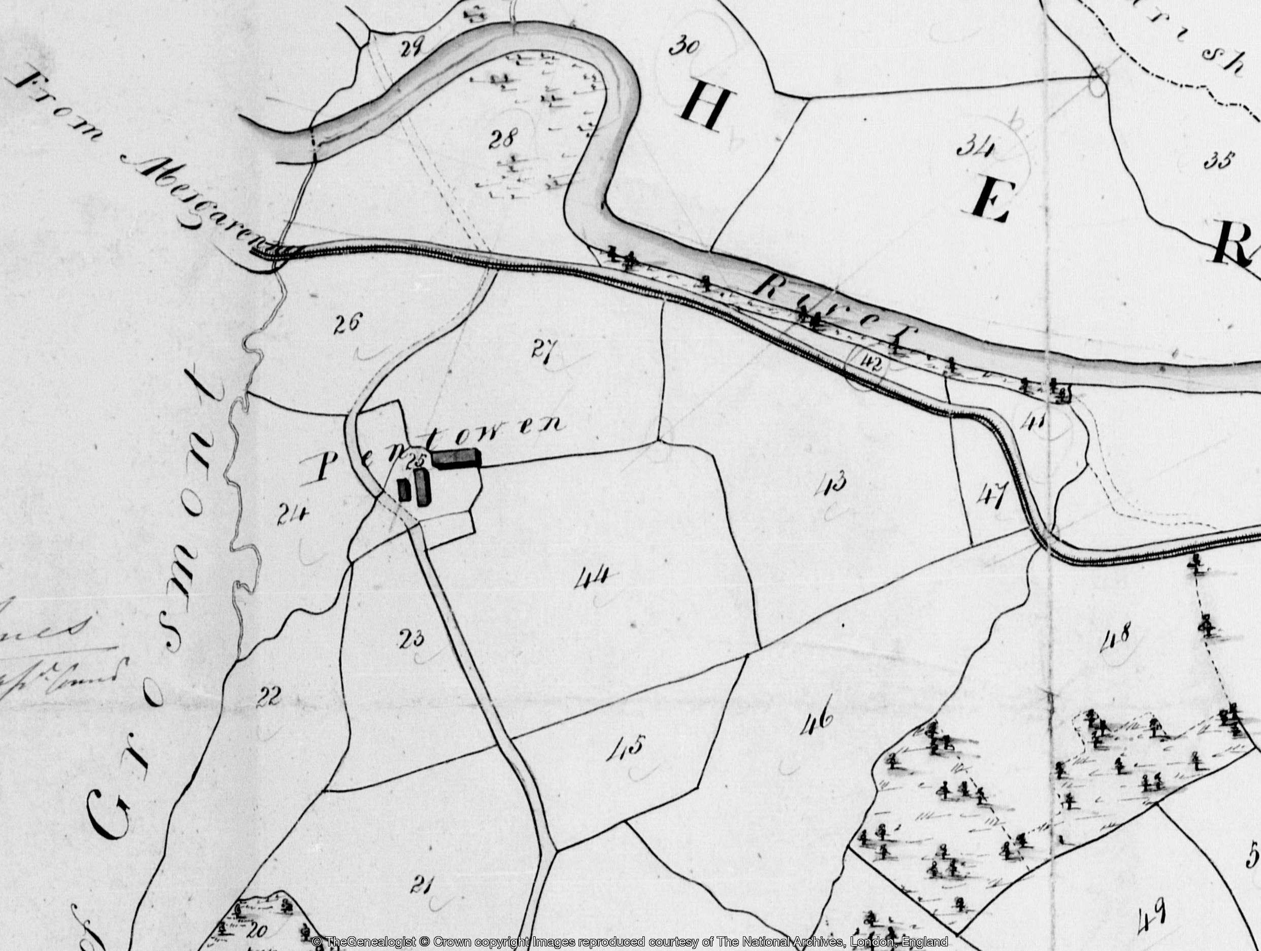
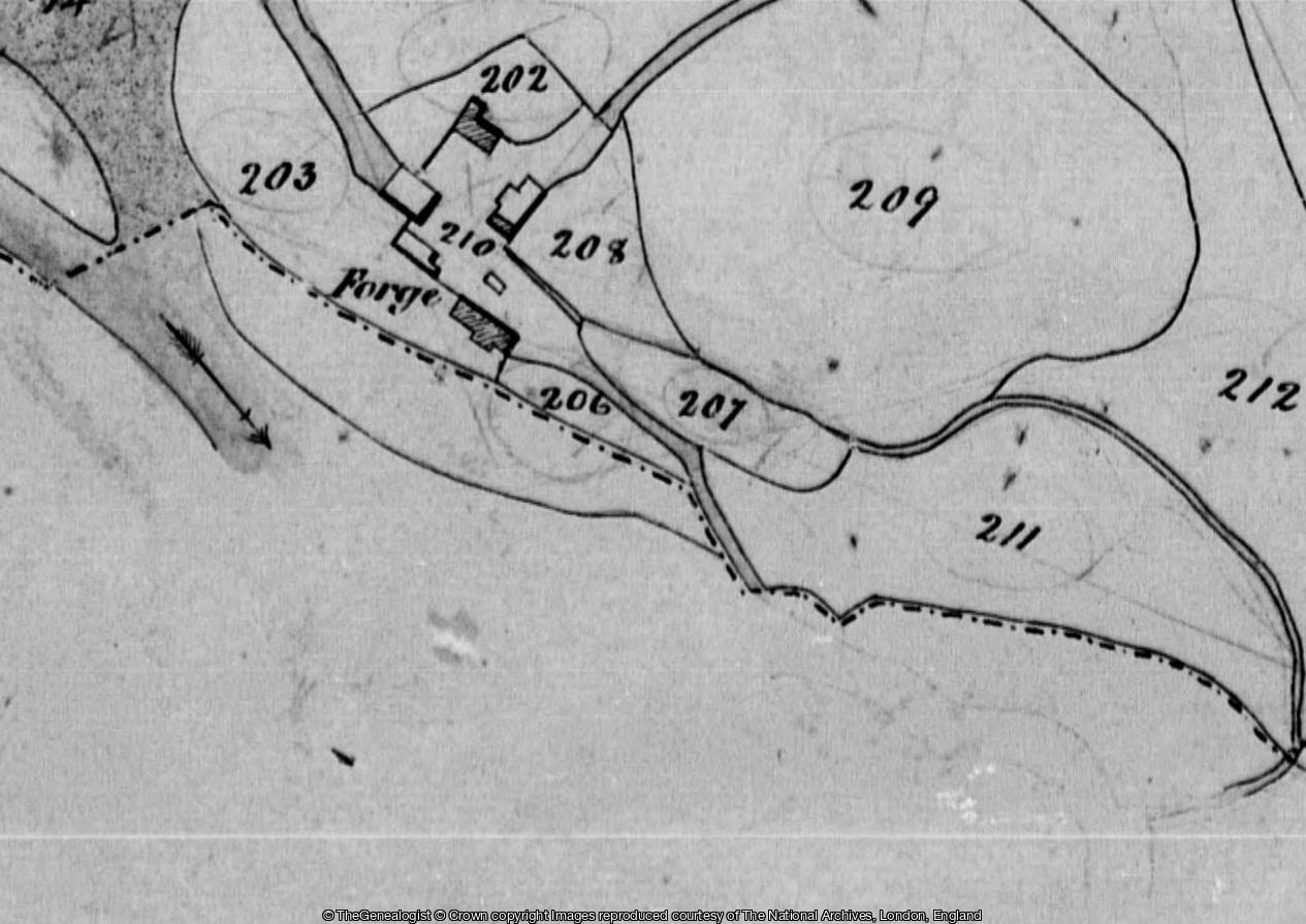
18. Pentowen, Llangua, county of Hereford and Llansillo Forge and The Star
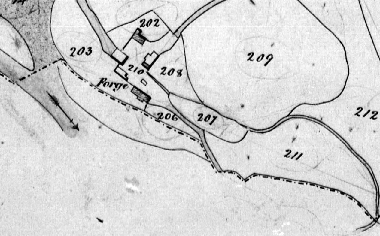
This estate map is difficult to correlate with the tithe maps for Llangua and Llancillo as most are not in the usual ' north to the top' orientation and part of the estate is separated by the Monnow which is not shown explicitly on the estate map. There is only a Herefordshire HER record (1487) for the Forge as Llangua is now in Monmouthshire. The Star is in Llangua and is shown on the 25in OS map as a single building. The Llangua tithe map shows Pentowen and the Llancillo tithe map the Forge as plot 203.
The HER for Monmouthshire can be searched following this link but there is no record for Pentowen.
19. The Hom, Llanfihangel, county of Monmouth
20. Pen Bidull (Penbiddle), Llanfihangel, county of Monmouth
21. The Middle Goitre, Llancillo (Lansilo), county of Hereford
This estate is called just ‘Goitre’ on the Llancillo tithe map where the homestead is on plot numbers 117 and 123. It lies to the north side of the parish very near to the Monnow. Although the estate map agrees well with the tithe map (when rotated) the Scudamores no longer owned the property at the time of the tithe map. It is difficult to match this with the 25in OS map as the railway has cut a swathe through the property.
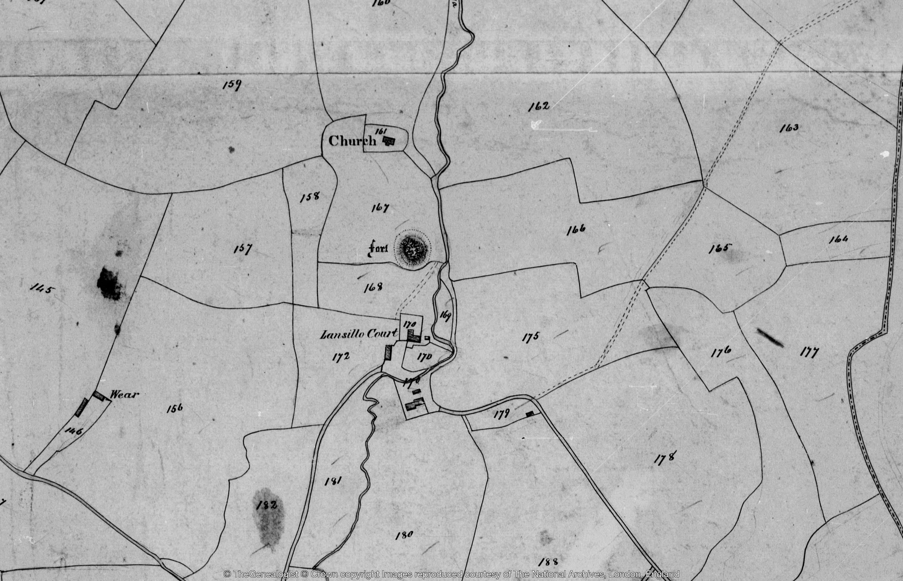
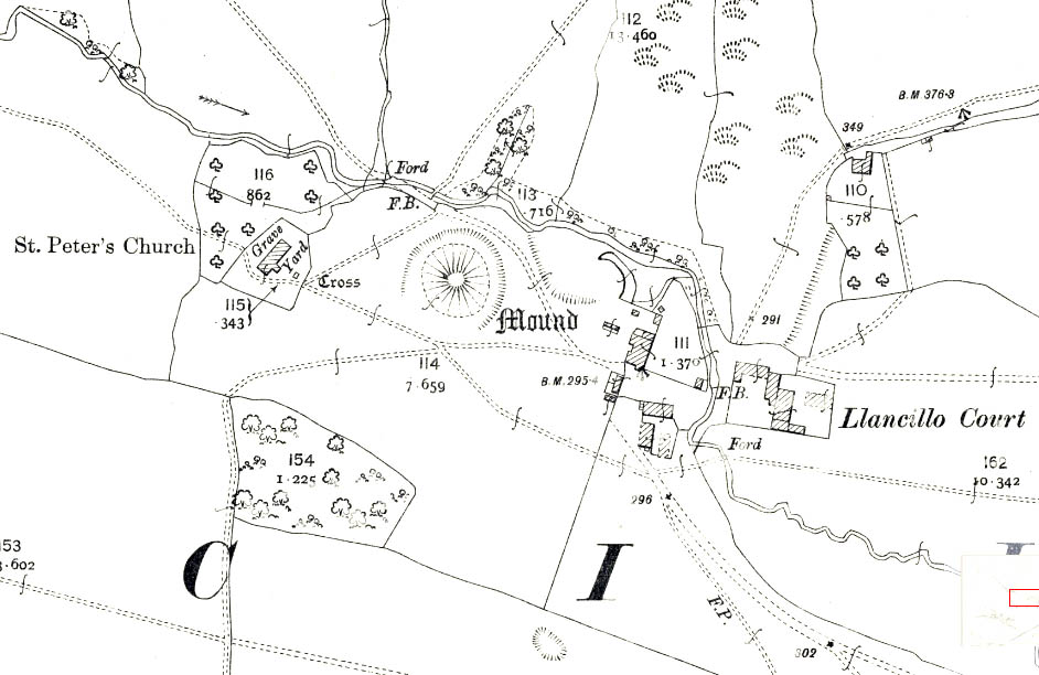
22. Llancillo Court and the Weir, Llancillo, county of Hereford
HER 6195. Llancillo Court is plot no. 170 on the tithe map. OS 25in map.
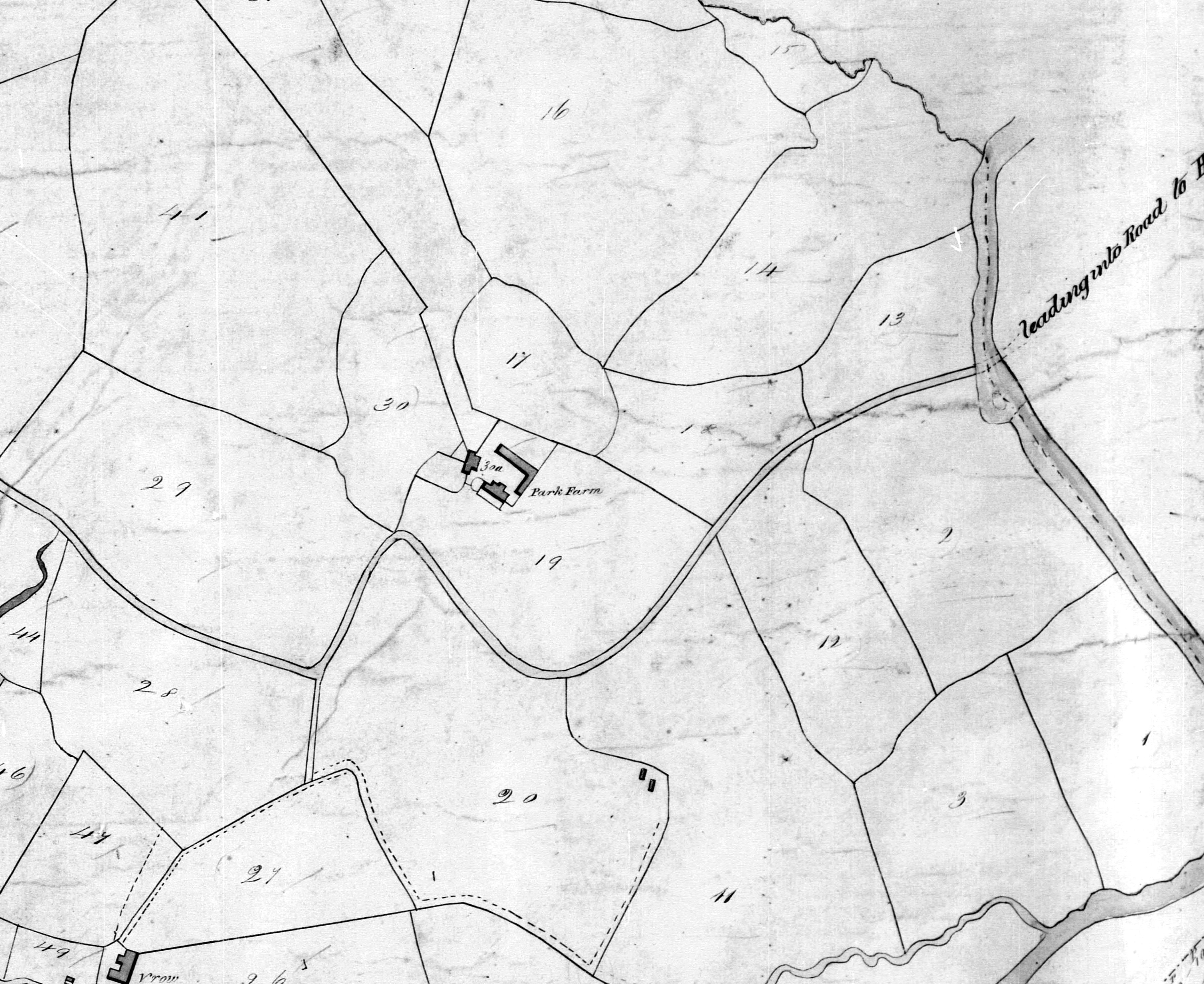
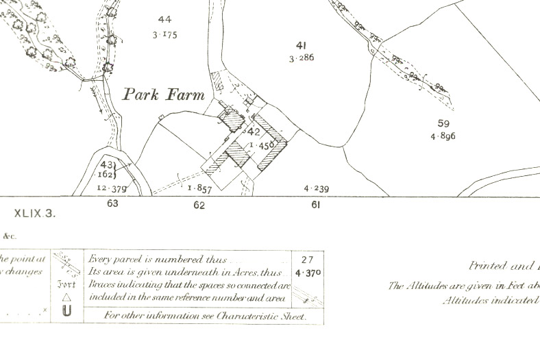
23. Rowlstone Park, Rowlstone, county of Hereford
Now Park Farm HER 9176. Plot 30a on the Rowlstone tithe map. Farmstead on the OS 25in map
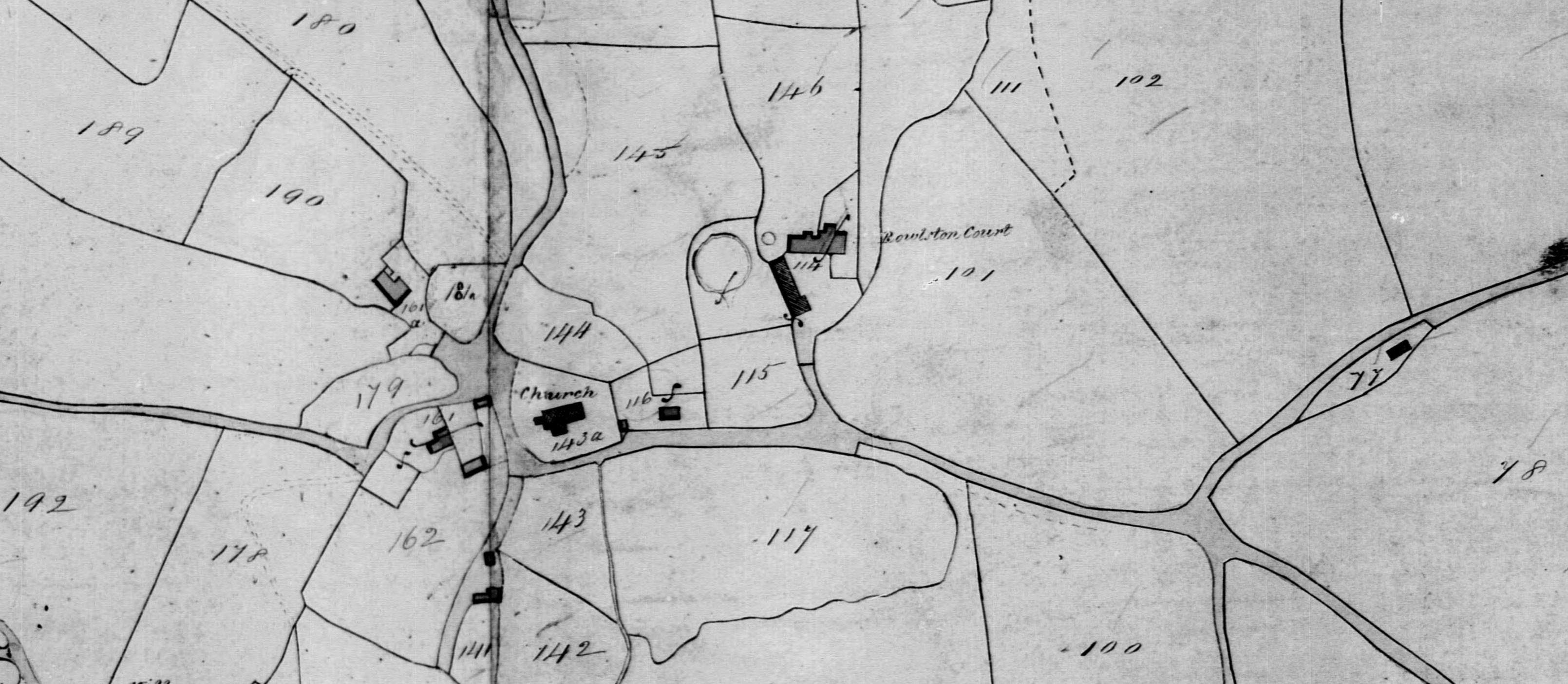
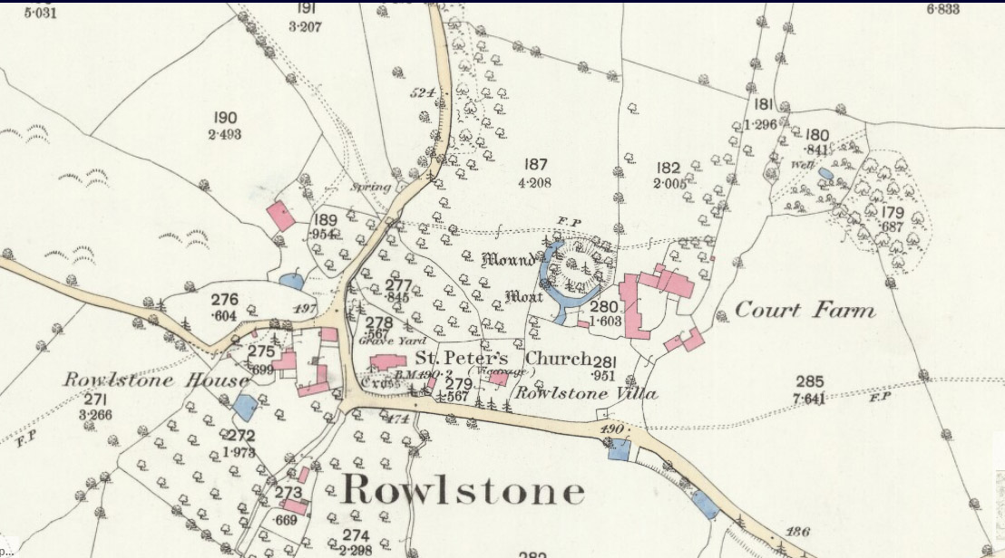
24. Rowlstone Court, Rowlstone, county of Hereford
No. 114 on tithe map, HER 45430. Historic lanscape shown well on 25in OS map.
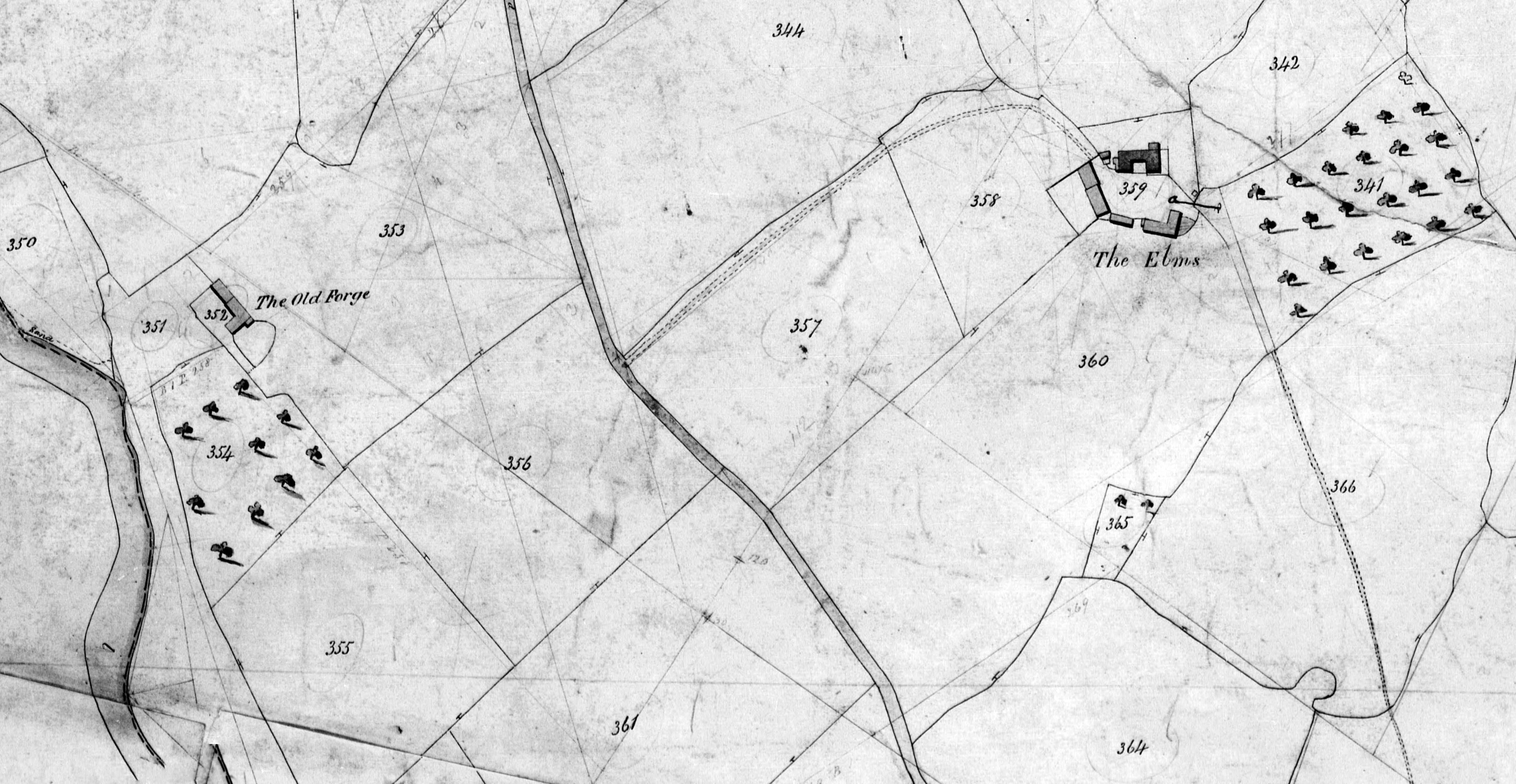
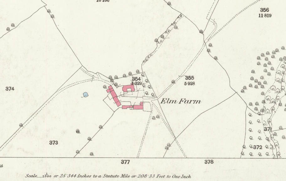
25. The Elms & Old Forge, Kentchurch and Grosmont, counties of Hereford and Monmouth
The Elms is HER 47369 (SO 40682 26377) and Old Forge 17304. On the Kentchurch tithe map The Elms is plot 359 and Old Forge 352. They are on different 25in OS map sheets: The Elms and Old Forge
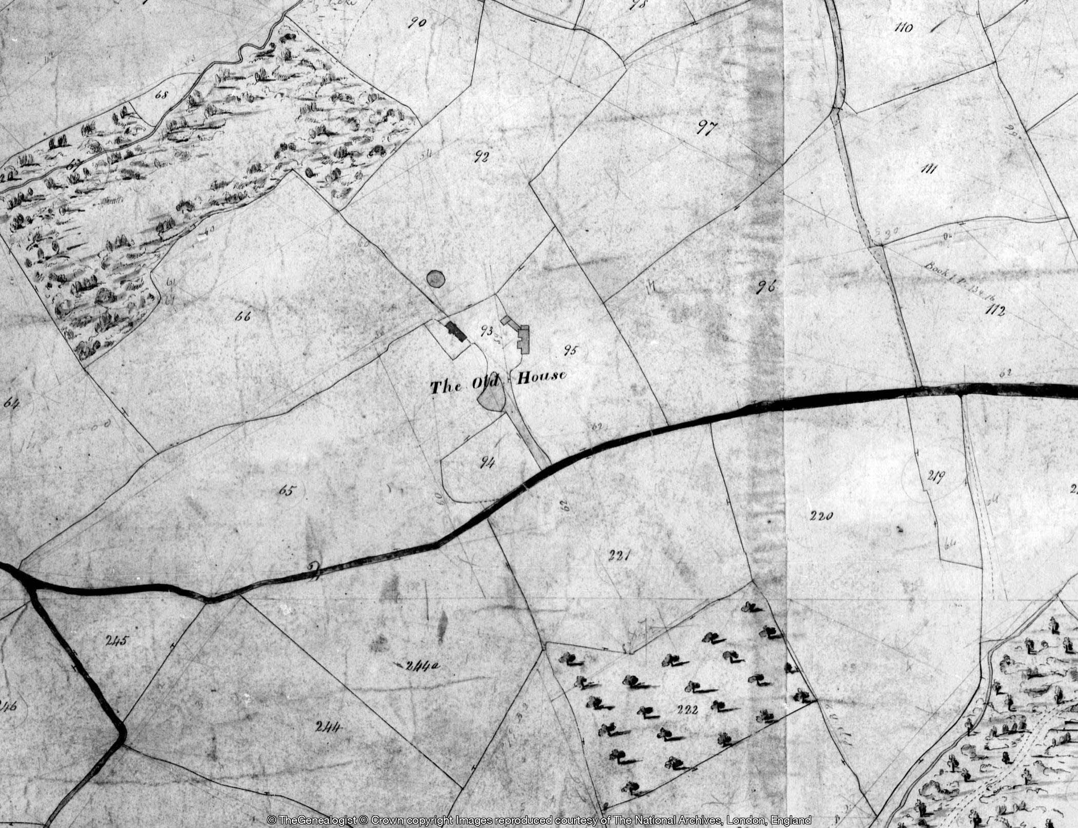
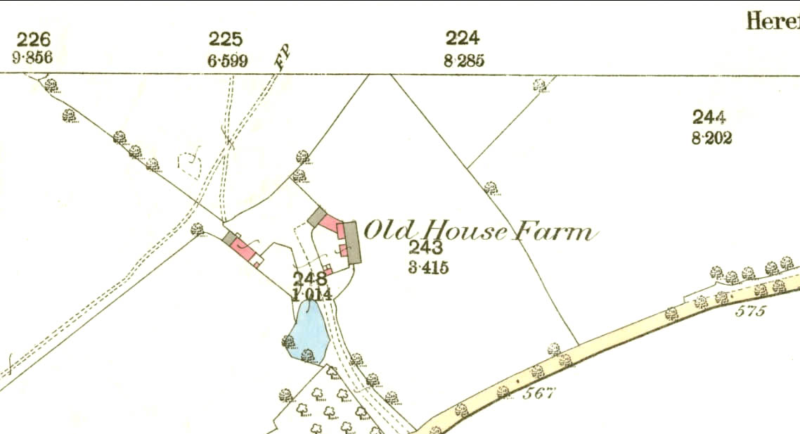
26. Kentchurch Hill, Kentchurch
HER 47360. On the estate map the farm is also titled Ralph’s Farm. Called The Old House on the tithe map no 93 and Old House Farm on the 1886 25in OS map.
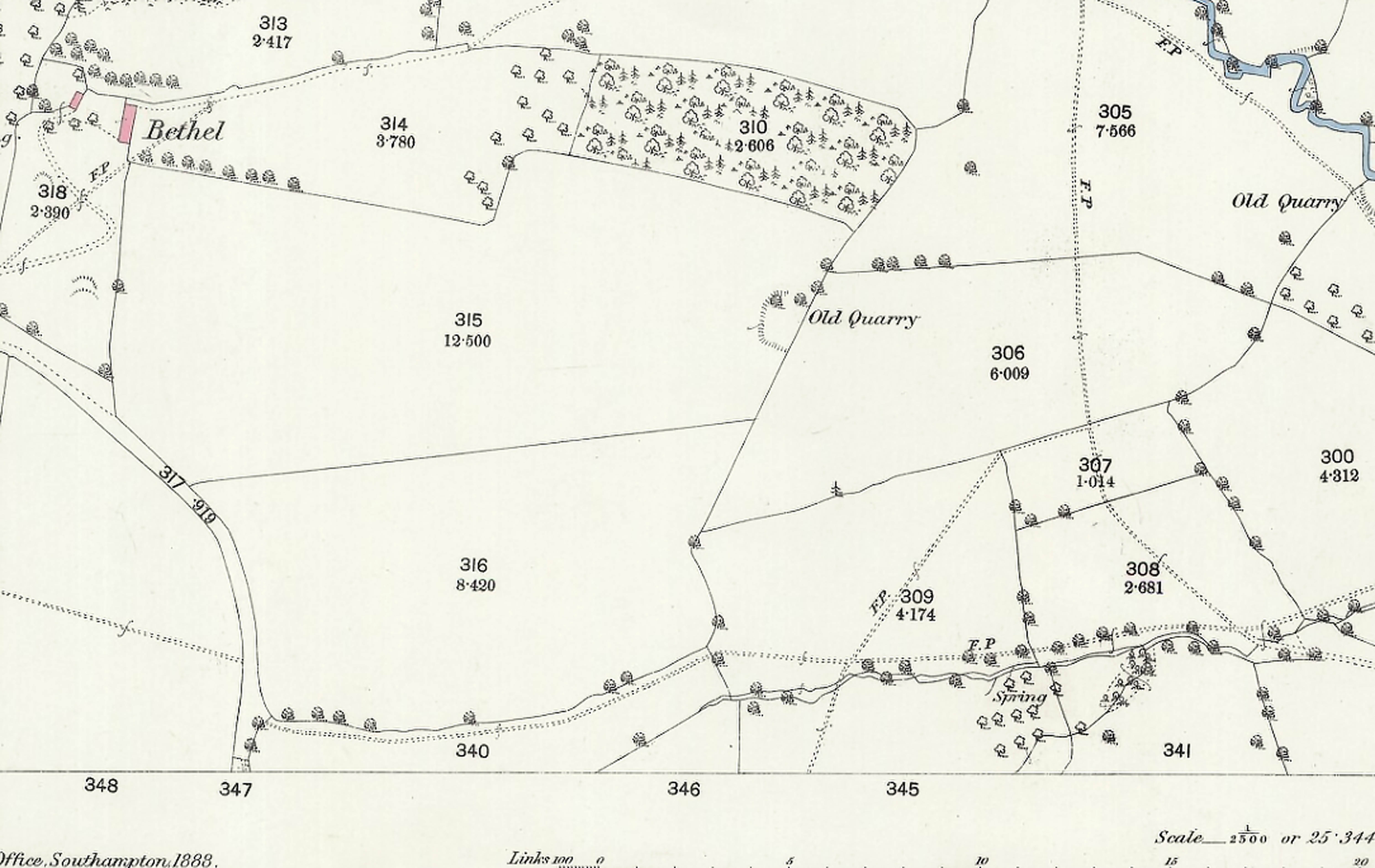
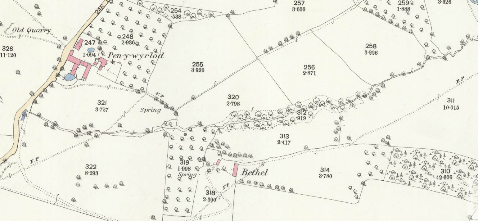
27. The Bithel, Rowlstone, county of Hereford
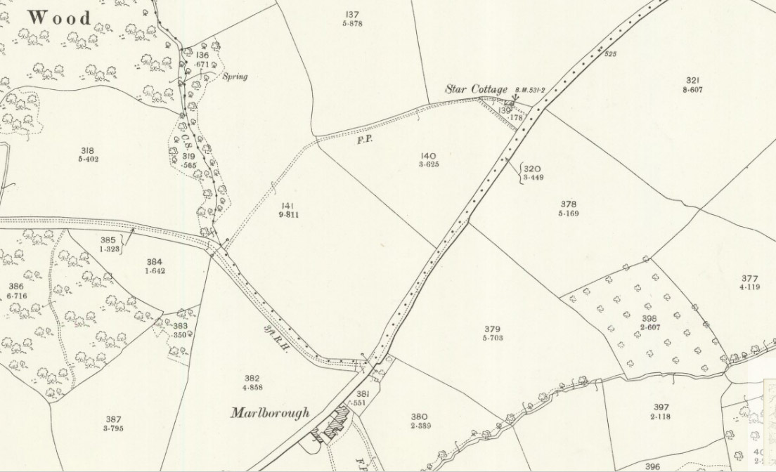
HER 45432 SO 36729 26682. The Bithel (or more usually Bethel) is not named on the Rowlestone tithe map but is shown in plot 200. The 1886 OS 25in map calls it Bethel. The estate map is interesting as it shows an area (in plot 17) with part marked as a spring on the 1885 map (tithe plot 135b).
28. The Cap-Farm, Llangua, county of Monmouth
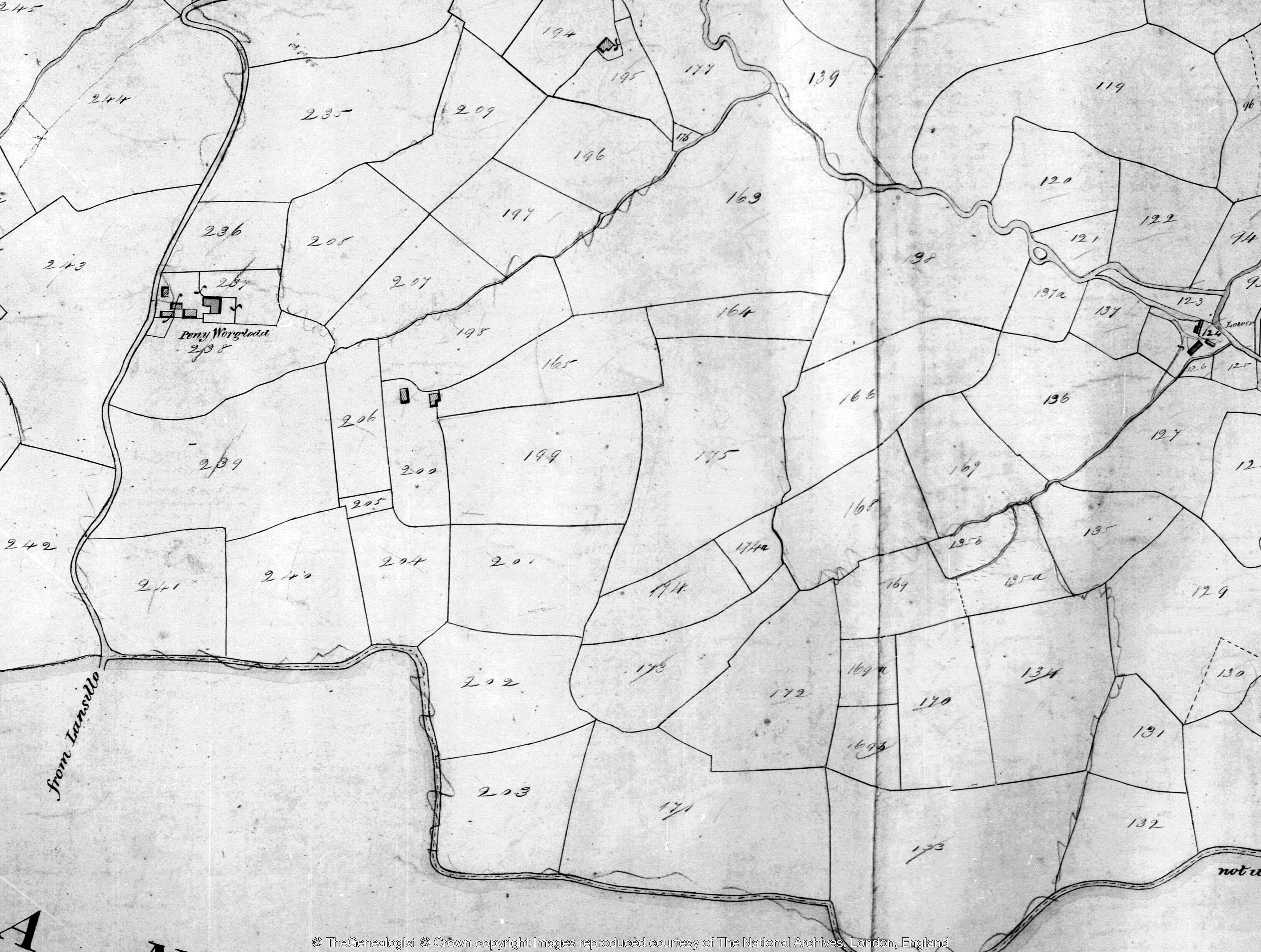
29. Pen-y-worlodd, Rowlstone, county of Hereford
HER 9173, The farm is plot 238 on the Rowlstone tithe map where it is called Peny Worglodd. The 25in OS map shows its close relationship with Bethel. RCHME monument 9.